Mapumental

A web tool showing public transport travel times on a timebanded map

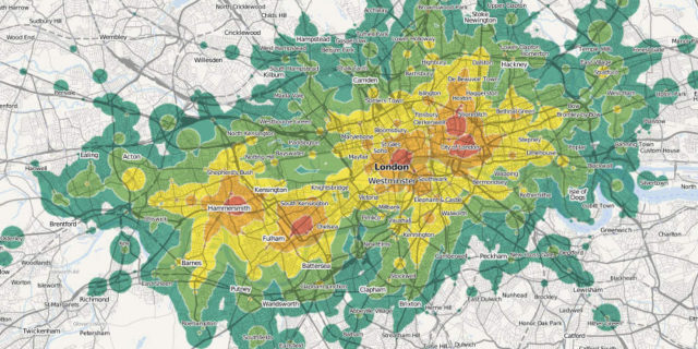
Mapumental is a web tool that shows public transport travel times, from or to a chosen postcode, on a timebanded map. These maps can be embedded in websites, apps or online tools, or used for internal research purposes.

Transit-time maps, also known as isochrone maps, are not a new idea: there are examples dating back hundreds of years. But the online technologies behind Mapumental are new – and have unleashed a great many possibilities for all kinds of users.

How Mapumental can work

  1. Interactive travel time maps: Tap in a postcode and see the possibilities
  2. Public transport accessibility maps: Maps that show accessibility at a glance
  3. Custom travel time maps: Present data in a way that everyone can understand

Features

Flexible

Mapumental was designed to work with whatever data sets you have, such as house prices, fire engine journey times, even levels of ‘scenicness’.

Static or dynamic

Mapumental can provide static maps ready for print and web publication — or interactive maps that reflect user inputs in real time.

A variety of outputs

The maps can be PNG image files or a GRASS ASCII grid raster suitable for use with GIS software — or, with the API, pretty much whatever format you need.

Various uses

Mapumental maps are already hard at work in the property sector, local government, charities, tourism, research and town planning etc.

Mapping public transport provision

The Welsh Government has used this tool to understand how well they were serving their rural populations with public transport.

Mapping fire engine response times

The Fire Protection Association needed a way to calculate insurance premiums based on how quickly fire services could attend.

Mapumental Property

Mapumental meets property data, helping house-hunters find property within their desired commute.

Mapping affordable homes

Mapumental helped the housing charity Dolphin Living find the best deals for their clients.