Treepedia is an interactive website which allows users to view the location and size of their city’s trees, submit information to help tag them, and advocate for more trees in their area. The green canopy plays an important role in urban life, with trees helping to mitigate extreme temperatures, provide natural respite from traffic, noise, and congestion, and improve the quality of our urban environment. Despite this, the average citizen is often removed from the understanding and development of their environmental habitat.
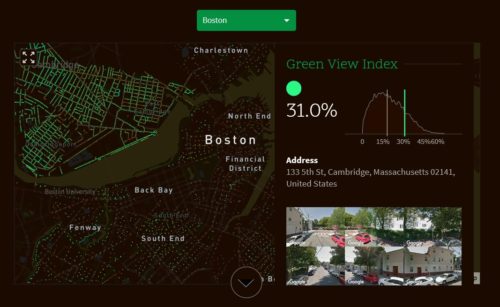
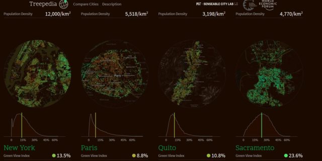
In response, the Senseable City Lab have developed an innovative metric called the ‘Green View Index’, using Google Street View panoramas to evaluate and compare green canopy coverage in major cities. Through monitoring the urban tree coverage, citizens and planners can see which areas in their city are green and not green, compare their green canopy with other cities, and play a more active role in enhancing their local environment. As Carlo Ratti, Director of the Senseable City Lab, says:
As many cities experience warming temperatures, increased storm frequency, and continued air pollution, the well-being of our urban trees has never been more important. We present here an index by which to compare cities against one another, encouraging local authorities and communities to take action to protect and promote the green canopy cover.
The project was developed by researchers at the MIT Senseable City Lab and in the development of Treepedia, it recognizes the role of green canopies in urban life, and asks how citizens can be more integral to the process of greening their neighborhoods.
A publication explaining in detail the way this application has been developed can be found here.