2nd City Zoning is an interactive map that visualizes the land uses of the buildings of Chicago as well as more information about the specific characteristics of the buildings. The aim of this project is to make the zoning regulations more accessible and comprehensible to the citizens.
2nd City Zoning
An interactive map that visualizes land uses and building typology
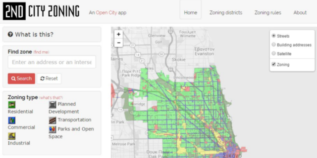
This application lets you:
- Find out how each building is zoned
- Use it as a helping tool for decision of place selection for a house, a business etc.
- Explore zoning patterns through the city
- Get familiar with urban regulations and zoning ordinance.
The application is being used by the City of Chicago.