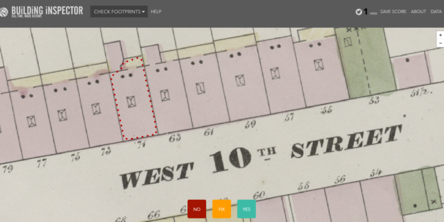
Building Inspector is an open tool that promotes public engagement for the extraction, correction and the analysis of data provided by historical maps. As volunteers inspect polygons, the API endpoints below get updated on a daily basis to reflect the latest data (both the perfect and the imperfect bits). The New York Public Library (NYPL) is training computers to recognize building shapes and other data on digitized insurance atlases. Via these easy, bite-sized tasks, you can help check the computers’ work and capture other valuable information
The maps in Building Inspector come from historical atlases of New York City which, rather than being one big map, are split into pages as they’re in books. Polygons come from atlas sheets which are scanned one at a time and then geo-rectified via the NYPL Map Warper. The vectorizer goes through each map sheet and extracts buildings as best it can. And it’s not good enough; that’s why this site exists: to validate and improve the output of the vectorizer.

