DistrictBuilder

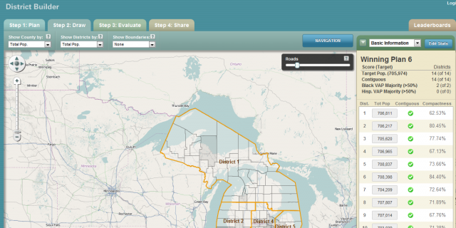
Web-based software for encouraging public participation and transparency in redistricting of state and local legislative district boundaries.

DistrictBuilder was developed by Azavea  in collaboration with leading redistricting experts at the Public Mapping Project. Whether you work for a state or local government agency, an advocacy group or you are a legislator, DistrictBuilder has been designed to provide you with affordable, easy-to-use, customizable redistricting tools that make the redistricting process more open and collaborative across agencies and with the public.

Unlike proprietary solutions, DistrictBuilder is open source so you don’t have to pay a license fee.  If your team has the expertise, you can download the source code and build your own redistricting application.  Or our dedicated DistrictBuilder implementation team can work hand-in-hand with you to create the perfect application for your needs.  And if we built a new feature for your application, it is immediately contributed back to the community of users.  The more you add, the more we give back.

  • Create and edit district plans
  • Use template plans to get started faster
  • Import and merge plans from other systems
  • Display demographics, election and other data
  • Integrate with GoogleMaps, Esri ArcGIS Online, OpenStreetMap or Bing maps
  • Show additional reference map layers, like school districts and administrative boundaries
  • Automatically calculate contiguity, compactness and population statistics as you create your plan
  • Customize demographic, geographic and election data statistics on-the-fly as you build your plan
  • Find unassigned areas
  • Draw communities of interest and evaluate a plan against them
  • Evaluate how closely your proposed plan matches legal requirements
  • Save and share your plans via a URL link
  • Support public competitions, scoring and leaderboards

DistrictBuilder is used in the following US cities:

View all installations here