Applications using PostGIS

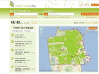
OpenTreeMap
Enables individuals, organizations, and governments to collaboratively contribute to an interactive and dynamic map of a community’s tree population
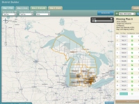
DistrictBuilder
Web-based software for encouraging public participation and transparency in redistricting of state and local legislative district boundaries.