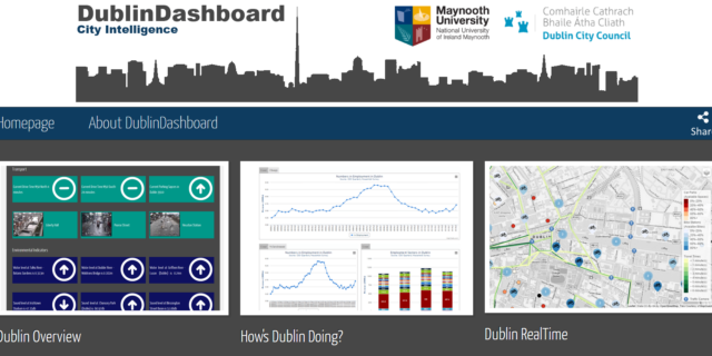
The DublinDashboard pulls together data from major data sources — including Dublin City Council, Dublinked, Central Statistics Office, Eurostat, and government departments, and links to a variety of existing applications — to provide thousands of interactive data visualisations. The underlying data is freely available so others can undertake their own analysis and build their own applications and visualisations.
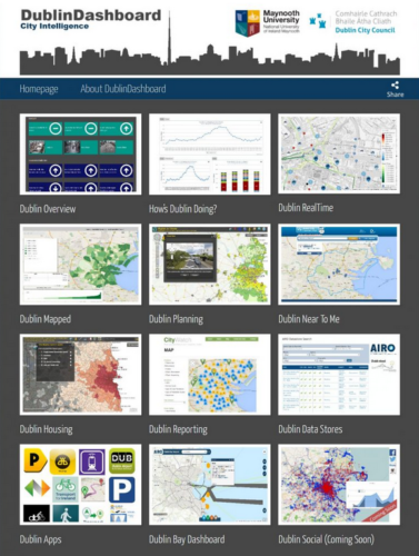
The website consists of several modules, each of which contains a number of apps. The modules are the following:
- Overview – Dublin Overview: basic information about the city including transport, environment, industry, employment & labour markets, housing, helath & crime.
- Economy – How’s Dublin Doing?: reports about the economic status of the city, including public spending, city benchmarks, cost of living etc.
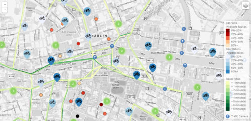
- Transport & Environment – Dublin Real Time: real time information about environment and travel maps.
- City Maps – Dublin Mapped: information presented in maps related to census, historic environment, city growth, etc.
- Urban Planning – Dublin Planning: city planning applications and tools.
- Community Amenities – Dublin Near To me: information and maps related to accessibility and community issues.
- Housing – Dublin Housing: useful information about housing sites, land prices, vacancy rates as well as land surveys.
- Reporting – Dublin Reporting: sites for citizens to report any problem or other issue that need to be fixed.
- Open Data – Dublin Data Stores: Datastores, Open Data, APIs and EuroStat Urban Audit.
- Mobile Applications – Dublin Apps: a catalogue of all the useful apps for the city of Dublin.
- Bay Dashboard – Dublin Bay Dashboard: information related to Dublin’s bay, such as marine traffic, a bay viewer etc.
- Social Services – Dublin Social: this module is under construction.
In this video, more information can be found about the functionality of the DublinDashboard.
Dublin Dashboard Homepage