GeoTrellis

An open source geographic data processing engine for high performance applications.

The power of spatial analysis can be applied to making better decisions about where to invest in economic development; where to site a hospital; or where to ship consumer goods to best meet demand. As geographic analysis routines become more sophisticated and execute upon increasingly larger datasets, the need for more powerful geoprocessing systems becomes critical. GeoTrellis is an open source high performance geoprocessing engine that performs commonly needed geographic operations with speed, scale and an open architecture, enabling analysis applications that have previously only been possible with a workstation GIS to be made available online and in mobile apps.

Distributed Geoprocessing

By breaking geoprocessing tasks into concurrent units of work, GeoTrellis harnesses the power of multiple cores, processors and servers to deliver analytic results in nearly real-time. Operations are accelerated by multiple orders of magnitude, enabling applications to interact with data in dramatically new ways. For instance, some commonly used operations can return results in less than 100 milliseconds providing a real-time environment to the end user.

Faster is not just faster, it’s different. For example, a truly responsive user experience makes it possible to create public participation planning tools or educational games that incorporate sophisticated geospatial models.

New Types of Applications

Whether your data analysis strives to improve public safety, prioritizes areas for environmental preservation, educates, informs policy or simply increases your bottom line, quick and easy access to geographic analysis can transform the way you accomplish your work. By integrating GeoTrellis into your applications and workflows, you can leverage the performance enhancements that high performance geoprocessing provides. This can not only save you time but also dramatically transform the way your application interacts with geospatial data. Functionality that would traditionally be exposed to users by a confusing sequence of dialogue boxes and progress indicators can suddenly become interactive, live controls with which to explore data — all due to the speed of GeoTrellis.

Spatial Operations

By accelerating commonly used spatial operations, GeoTrellis transforms your computational workflow and enables your applications to expose new ways of interacting with geospatial data.  Individual component operations can be linked to form composite models.

High Performance Geoprocessing

GeoTrellis accelerates geoprocessing tasks by harnessing the power of multiple cores, processors, and servers through distributed geoprocessing. By doing so, processes complete faster allowing you to build applications that are radically more engaging.

Deployment Strategies

Built as a flexible framework, GeoTrelils can be deployed in many ways depending on the particular needs of an application.  It can be deployed on-premise as an installable software package, embedded within other software, or deployed to cloud environments.

  • CommonSpace
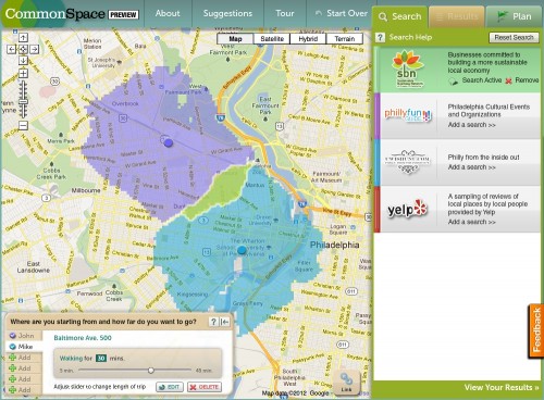
    CommonSpace is a prototype sustainable transportation tool that enables the public to plan local trips via walking, biking and public transit. It supports multiple starting points (for different members of a group), then calculates the “transit-sheds” and their intersection to show the best places to meet for beers, shopping, coffee and entertainment events.

Geotrellis - CommonSpace

  • Walkshed
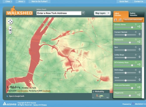
    Walkability is the first step to urban sustainability. Walkable neighborhoods are more convenient to their residents, reduce our impact on the environment, and improve the health of our citizens. Walkshed, currently implemented in Philadelphia and New York, enables a user to select from a number of different community assets and calculate their own personal walkability map.

Geotrellis - Walkshed

  • City of Asheville, Priority Places
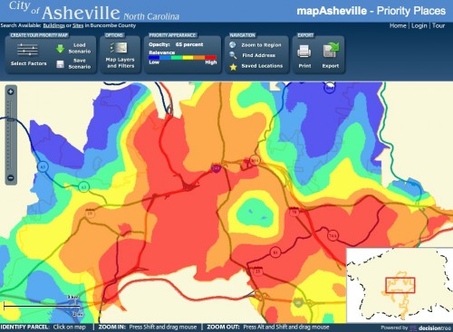
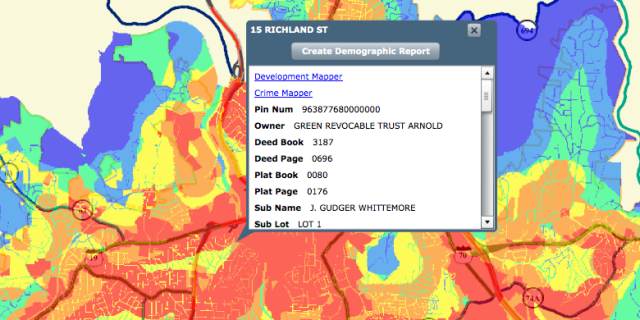
    Priority Places was developed to enable citizens and entrepreneurs to pick ideal sites for facilities, activities and businesses according to criteria of their choice. Visitors to the website can select a series of “decision factors” to create a siting scenario, assign weights to each factor and then generate a “heat map” showing the locations best satisfy the factors and weights. They can then interactively adjust the weights and factors, revising the priority map in real time.

Geotrellis - City of Asheville